The Carpathian Mountains, with heights over 2500m, stretch for about 1500km across Romania, covering a third of the entire country surface. They formed the habitat for the largest European populations of brown bears, wolves, chamois, and lynxes, as well as for over one third of all European plant species, being the home to the second-largest surface of virgin forests in Europe.
Beside wild animals and flora, what is in abundance in all these mountains, are the trails. Either crossing dense forests, zigzagging from hut to hut at over 2000 metres, flowing along rivers or being sketched on rock walls, these are under the footpaths of hikers, cyclists, climbers or skiers with a passion for nature and sports. And if you just can’t get enough of it, there is also the wind to help the paraglide raise high above the trees and exposing the mountains in all its mighty to the flyers.
As there are mountains for everybody, only the time will decide if you want to go for a day hike around Brașov or Sibiu or if you want to enjoy for a longer time the Alps of Transylvania, as French geographer Emmanuel de Martonne described the southern Carpathians.
Day hikes in Brașov
Being surrounded by mountains, Brașov gives the chance to outdoor lovers to enjoy wild trails in just minutes, starting from the city center and heading towards high alpine peaks.
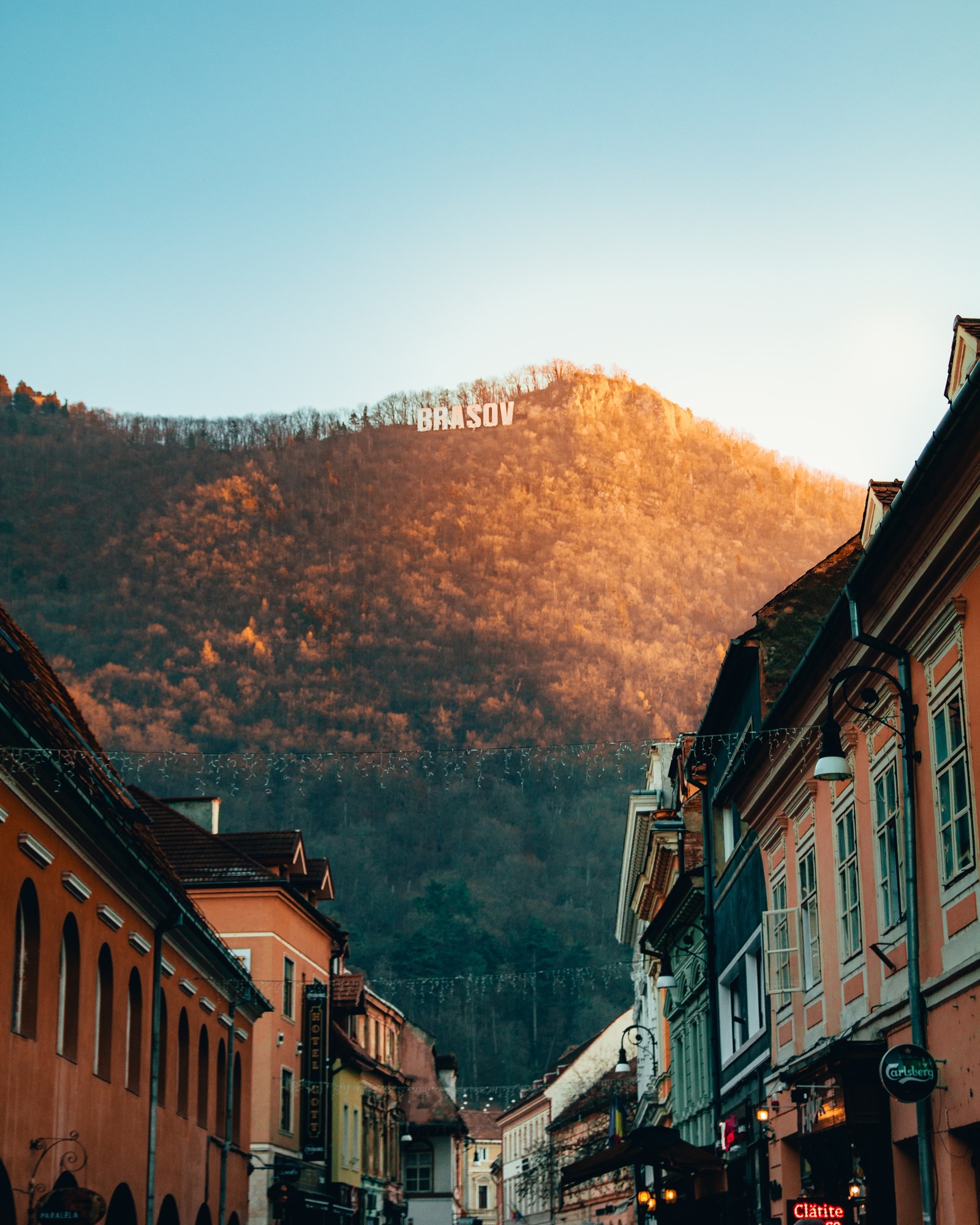
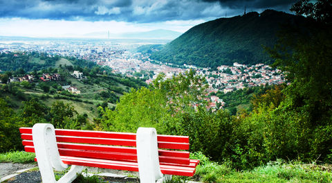
The easiest hike you can do is to climb the Tâmpa Mountain in order to admire a breathtaking view over the old city.
From the main square Piata Sfatului head towards the “green wall” with the Brașov sign at the top, and in just minutes you will reach the forest limit at the Christian Kertsch Aqueduct. From here you will find the trail marked with the red triangle starting to climb up towards the Tâmpa Peak. After about an hour of hiking with stops in the strategic sightseeing points you will reach the top at 960m above sea level, and the location of the old Brașovia citadel.
As all photos have been taken, the path continues downwards towards the Tâmpa Saddle, a good resting place of peace and quiet, from where you can head back to the city centre following the thematic path or you can continue your adventure towards the next peak.
A full day hike can continue from here towards the Postăvaru Peak (1799m). Following the blue stripe marking, you will continue your climb through the Stechil Meadow towards the Postăvaru Chalet and to the rocky peak, all in about 4-5 hours from the start. The view that this peak is offering is limited only by the air visibility and the surrounding mountains: Piatra Craiului, Piatra Mare and Bucegi.
The way back to Brașov is either on the same blue stripe trail or going down the slope to (as the slopes from the Postavaru Massif form the biggest ski resort in Romania:) Poiana Brașov. Here you can continue on the old road down to the history charged Solomon’s Rocks and between the houses of Schei or following the main streets downward in Poiana Brașov you will reach the bus station which can take you back to the Brașov city centre in only 30 minutes. The last bus is hard to miss as it will wait till 23:00 until it will call it a day and return to the city for the night (life).
Although a hiking day in Brașov is accessible to everybody, it’s always good to have with you good hiking shoes, a rain and a warm jacket, snacks and a bottle of water. Maps of the area can be found in the local libraries or downloaded from mobile navigation apps.
See the route on a map here: https://goo.gl/maps/LPpfcRgvkgk
Piatra Craiului day hike
When talking about mountains there is always one that comes to mind for locals: Piatra Craiului (Kings Rock). It’s also called Crăiasa, or The Queen, as this is the most appreciated mountain in the Brașov area.
Having a knife like shape, it’s ridge stretch for about 25km from the foothills of the city of Zărnești and reaches heights of over 2200m (La Om Peak 2238m). With shear drops from either side of it’s ridge and because of the specific limestone structure and soils, this mountain is a protected area since 1938, hosting more than 30% of the total plants growing in Romania. Unique for this place, beside the large number of large carnivores like bears, wolves and lynx, are some endemic plants, from which the most renowned being the Piatra Craiului Carnation (Dianthus callizonus).
A hike here, as preferred by many is towards the Curmătura Hut and would start from the city center of Zărnești. To get here from Brașov would mean a 40 minutes drive or a one-hour ride with the public transport.