What is the Polish Corridor? In one way, it's a relatively simple thing to answer. On the other hand, explaining 'Why?' is alot more complicated. You may have come here searching for an easy paragraph, and we could've done that, but the fact is it requires a little more explanation...
What is the Polish Corridor?
We'll try and make it as clear as we can for you: The Polish Corridor (also known as the Danzig Corridor) is best known as a strip of land that provided the Second Republic of Poland (1920–1939) with access to the Baltic Sea, thus dividing the main body of Germany (Weimar Republic) from the province of East Prussia (See The Map Below!) Between 1920-1939, Danzig (now Gdańsk) was separate from both Poland and Germany as a semi-autonomous state overseen by the League of Nations (now the United Nations). It was known as The Free City of Danzig. The corridor and the economic rivalry between Poland and the Free City of Danzig directly contributed to the development of Gdynia as a major port city.
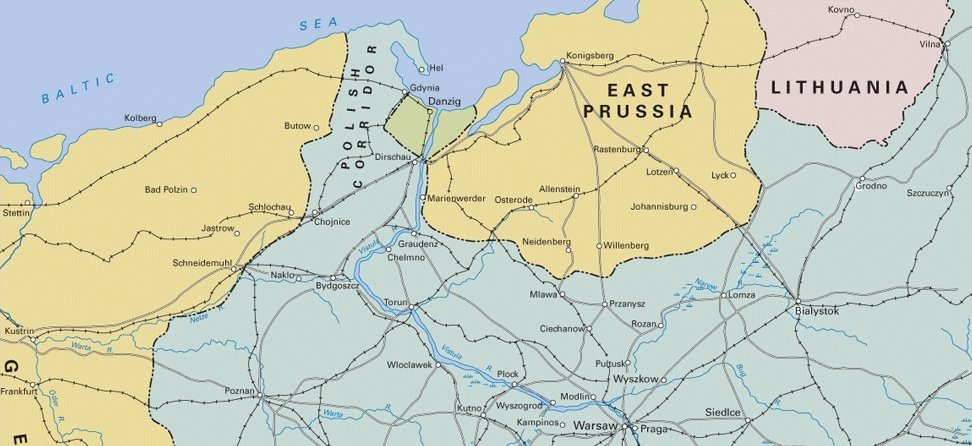
Map showing the boarder of Northern Poland between 1920-1939, where the Polish Corridor effectively divided Germany from its East Prussian territory and Danzig existed as a multi-ethnic free city state.
Although this term most-often associated with boarders of the Second Republic of Poland (1920–1939), a similar 'corridor' from the Baltic coast (most importantly, including the western side of the Bay of Gdańsk) to the historic 'main body' of Polish territory has existed in various forms over the last millennia, whether as part of a border of a provence, country, a frontier against pagan tribes or even just a region defined by its ethnographic make-up. Furthermore, this 'Polish' corridor has changed hands between Poland, Prussia, Germany, Sweden and Russia many times throughout history. Complicated? Yes... so get comfortable - We about to unleash this overfilled tax-folder onto the desk!
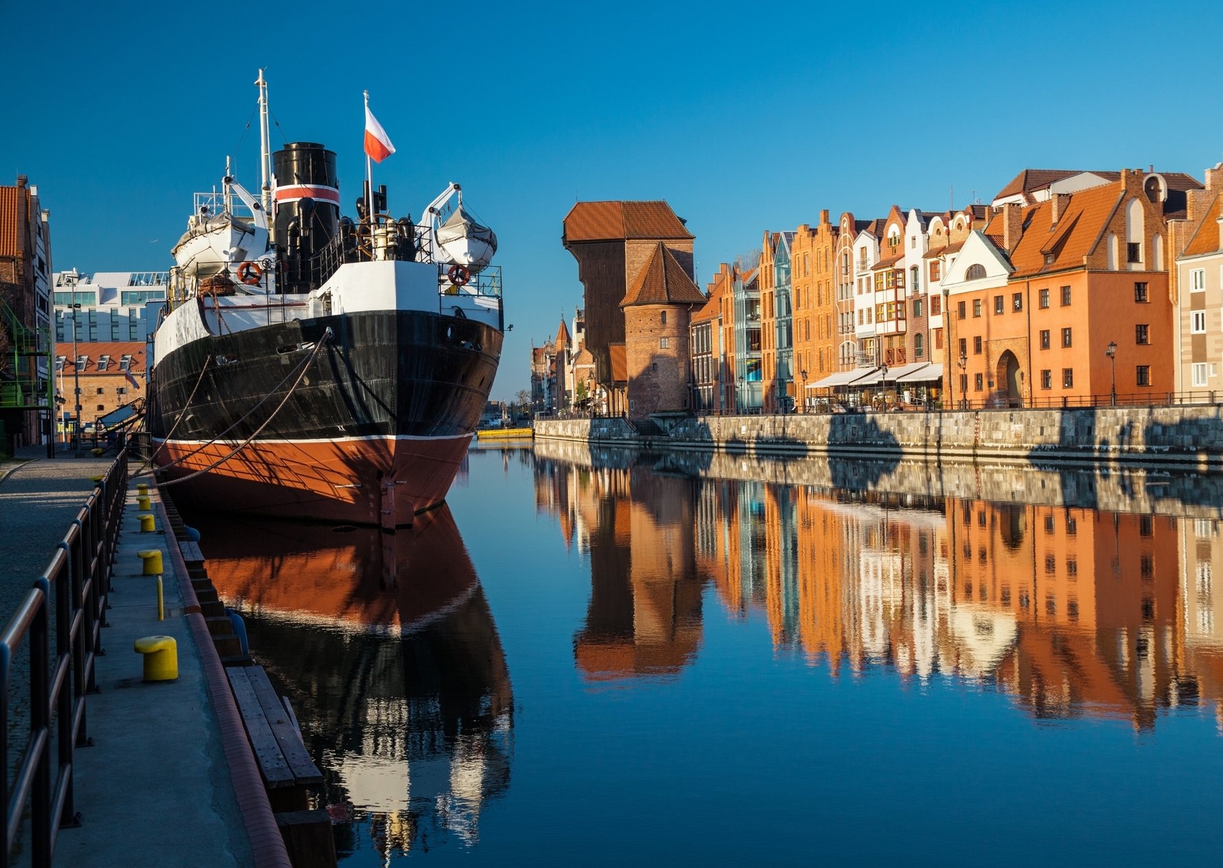
With a complex history of its own, the city of Gdańsk (or Danzig) would become an important factor in the creation of the Polish Corridor.
The Long and Complex History of Polish Borders
To understand the history of the Polish Corridor as it was mapped in 1920 and also the German territories on either side (as you can see on the above map), we need to go back aaaall the way to the creation of Poland in 960 under Mieszko I. On a side note, he would convert to Christianity shortly after and Poland was christened as well (remember this for later!). The borders were much different than they are now, but it did include a similar chunk of the Baltic Coast as well as the Bay of Gdańsk. Why was this important? The bay is where the Vistula, the main river that runs the full length of Poland, meets the Baltic. Quite simply, having access to the Baltic meant lots of sea-trading potential and the Bay of Gdańsk had good geographic position to achieve this. Gdańsk is first mentioned in written records from around 997 and archaeologists believe that Mieszko I probably built a stronghold here in the 980s after recognising the area's strategic importance. Needless to say, Poland, whether a Kingdom or a Republic, would do their very best to hold onto their sea-front over the proceeding centuries!
Map showing the Kingdom of Poland (960-992) under Mieszko I.
Although the Kingdom of Poland had control over the Bay of Gdańsk, the Baltic coastal area (often referred to historically as Pomerania) was otherwise inhabited by fierce Pagan tribes of Prussians and Balts. It was the surrounding Christian dominions that sought to bring God to these areas and so, to the west of the Polish Kingdom, the Holy Roman Empire, then under the Germanic Hohenstaufen dynasty, began expanding North-West Pomerania in 1181. This was the beginning of the 'Germanisation' of the region. On the other side of Poland, the Germanic Order of Teutonic Knights, who were essentially Christian mercenaries, were granted land by Polish King Konrad I to help consolidate and protect the north-eastern borders from the Pagan Prussian tribes in 1226. After this 'crusade', the Teutonic foothold in the area would gradually expanded to incorporate 'East Prussia' and even further up the east Baltic coast. It was during this time that the villages of Marienburg (Malbork) and Königsberg (Kaliningrad) were founded. The Polish 'gap' inbetween here and the Holy Roman territories was eventually closed when the Teutonic Knights turned on their former allies and invaded Gdańsk and the surrounding area in 1308.
The State of the Teutonic Order (Blue) in 1410.
They expanded into Danzig (Gdańsk) and its surrounding area in 1308
In the grand irony of history, 1454 saw the now-Christianised Prussians asking Polish King Casimir IV to help support their revolt against the Teutonic Order. This union allowed Poland to reclaim the western half of Prussia back and thus regaining the Polish Corridor once again! By this stage, the area we know as 'Pomerania' had largely become, both culturally and linguistically, a Germanic area.
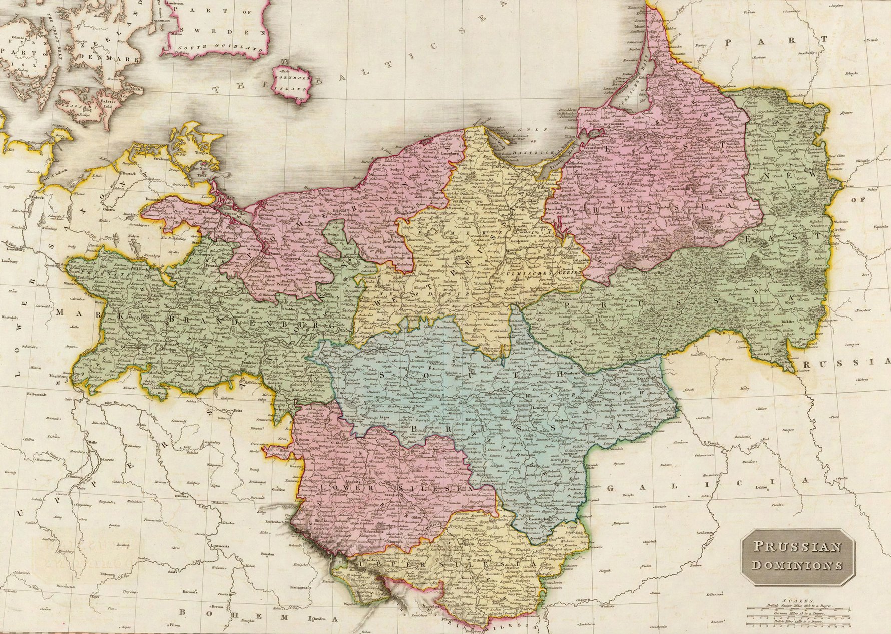
Map of the 'Prussian Dominions' following the Partition of Poland where the western side of the Polish Corridor formed the border of West Prussia.
If you thought the history of Northern Poland was complex enough by this stage, think again! The Polish-Lithuanian Commonwealth was formed in 1569 between Poland and the huge territory of Lithuania, which was twice the size of Poland at the time! Sweden invaded in 1655 and was pushed out in a matter of 5 years, though they had a few other conquests elsewhere in Polish territory. Amongst other growing empires in Europe, Russia began expanding its territories in the mid-18th century and briefly occupied Prussia in 1758. In turn, Prussia, inherited by the Margraviate of Brandenburg (the full territory would later become the Kingdom of Prussia), took over the whole of Northern Poland in 1772. In 1795, Russia, Prussia, and the Austrian Empire conspired and partitioned the Polish-Lithuanian Commonwealth, completely eliminating both countries for more than 123 years. Yes, complicated indeed...
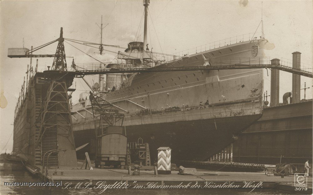
Founded in Prussian-occupied Gdańsk, the Imperial Shipyard (1871 - 1921) grew to become the largest shipyard in Europe.
Back from the Dead - The Second Republic of Poland
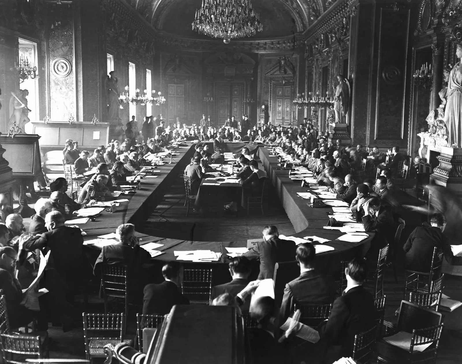
Amazingly, even after their country had ceased to exist for over a century and a half, the Polish identity and the idea of a Polish state still remained. Alliances and tensions forming in Europe would eventually culminate in the conflict of World War One in 1914. As we all know, Germany and Austro-Hungary lost along with the crumbling Ottoman Empire, and the newly-formed League of Nations (now the United Nations) converged in Paris, France in 1919 to redraw the map of Europe once again. This was known as the Paris Peace Conference.
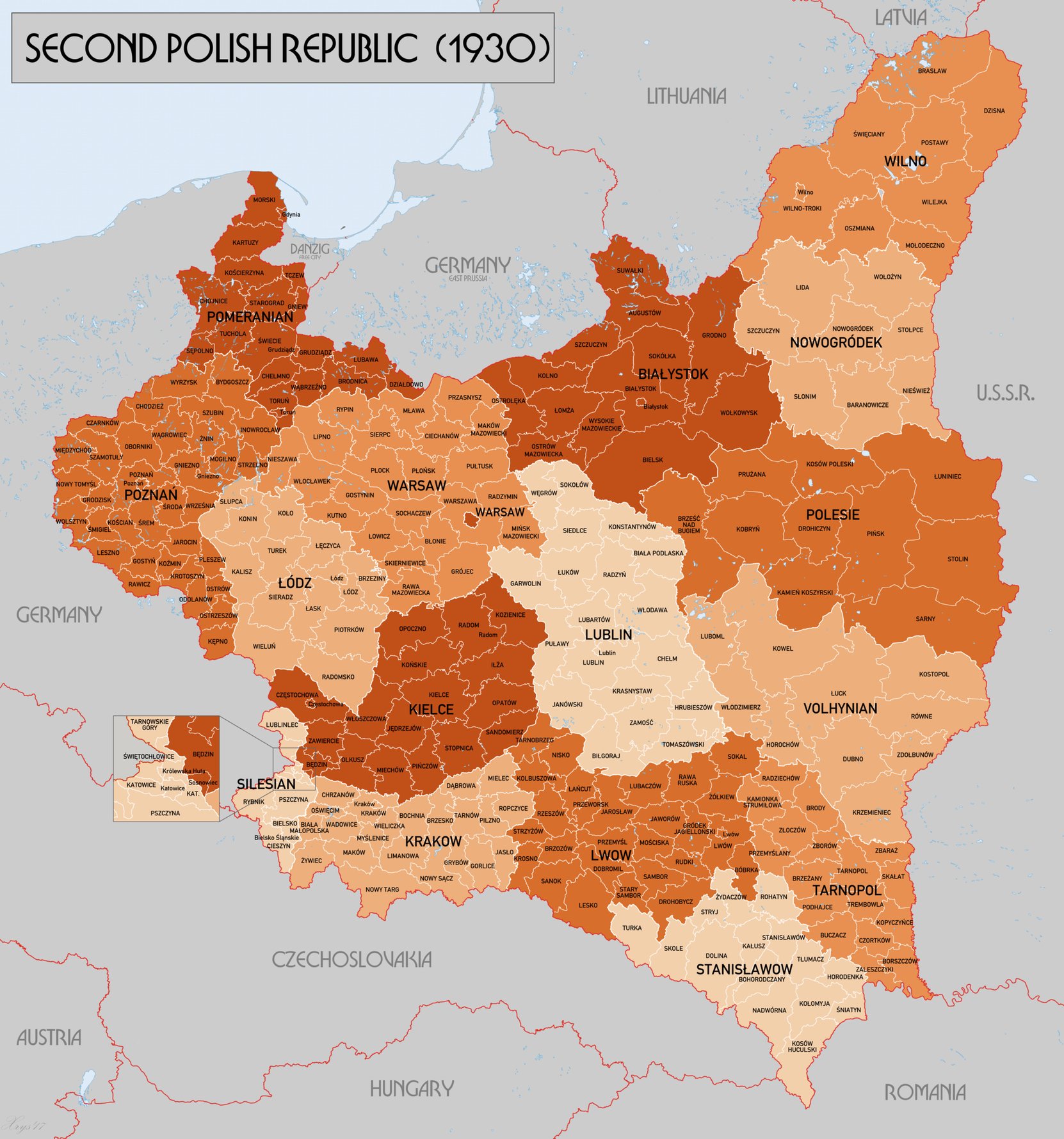
The Second Polish Republic (1920-1939). Map created by XrysD.
Polish independence activists, in particular, Roman Dmowski and Ignacy Paderewski presented a strong case to the delegation and it gained alot of favour. The borders against South-Eastern Germany, Czechoslovakia and the east were comparatively easy to draft. The argument for including a multi-ethnic Danzig (95.03% German, 3.28% Polish/Kashubian/Masurian, 1.69% Other) and territories on the Baltic were more difficult. It was this reason that the League of Nations turned Danzig into the semi-Autonomous 'Free City State' that was separate from both Germany and Poland.
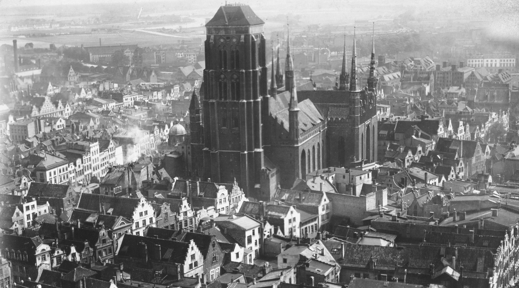
A photo of Gdańsk AKA Danzig in 1920, when it became a free city state.
The political and administrative arrangements in Gdańsk were complex and, quite frankly, deserves its own article! Though as a brief overview, Poland still controlled the railway system, since the tracks had to cross the Polish corridor from Germany. This meant that Poland also controlled what could be exported from Danzig. Poland also controlled the postal system and provided its military defense arrangements. Its important to remember that the demographics of Danzig, both in population and in government, was overwhelmingly German and so tensions existed from the Free City State's very inception. Following several port strikes in Danzig, Poland was motivated to develop its own port in Gdynia.
The Corridor is Drawn Up
There were two primary arguments for including the corridor into the Second Polish Republic's territory: Economics and Ethnographics.
Economics - Without Danzig in Polish territory, the Poles were at risk of having no access to the Baltic Sea. This would mean no economic independence and a reliance on the surrounding territories. This was recognised by 'The Inquiry', a 150-member team that researched all existing issues that were bound to arise at the Paris Peace Conference. They further concluded that East Prussia, which would be isolated from the main body of Germany, would still have adequate sea access from Königsberg (now Kaliningrad). The same inquiry suggested Danzig should become part of Polish territory but this proposal was ultimately declined, hence the creation of the Free City State!
A census map drawn up in 1910 showing majority Polish areas (Green)
and majority German areas (Orange) in central Pomerania.
Ethnographics-Although Pomerania had a predominantly ethnic German population, the corridor still remained densely populated with ethnic Poles. This particular case was strengthened by Kashubian representives, representing the minority West Slavic ethnic group who had lived in the area north-west, west and south-west of the bay of Gdańsk. The argument that Kashubia should be included in Polish Territory was spearheading by Antoni Abraham, a Kashubian activist who was undoubtedly disilusioned with German rule over the region, having been conscripted into the German Army, receiving serious wounds and losing his son and son-in-law on the western front.
In the wake of WWI, the Paris Peace Conference saw many new nations emerge (and re-emerge) on the world map, such as the 'Second Polish Republic'.
Based on The Inquiry's research, US President Woodrow Wilson's 'Fourteen Points', the statement of principles designed to maintain peace in the post-war world, specifically stated in Point No. 13:
XIII. An independent Polish state should be erected which should include the territories inhabited by indisputably Polish populations, which should be assured a free and secure access to the sea, and whose political and economic independence and territorial integrity should be guaranteed by international covenant.
From this, the borders of the Second Polish Republic were extended from the central-north historic 'main body' all the way to the Baltic Sea in 1920.
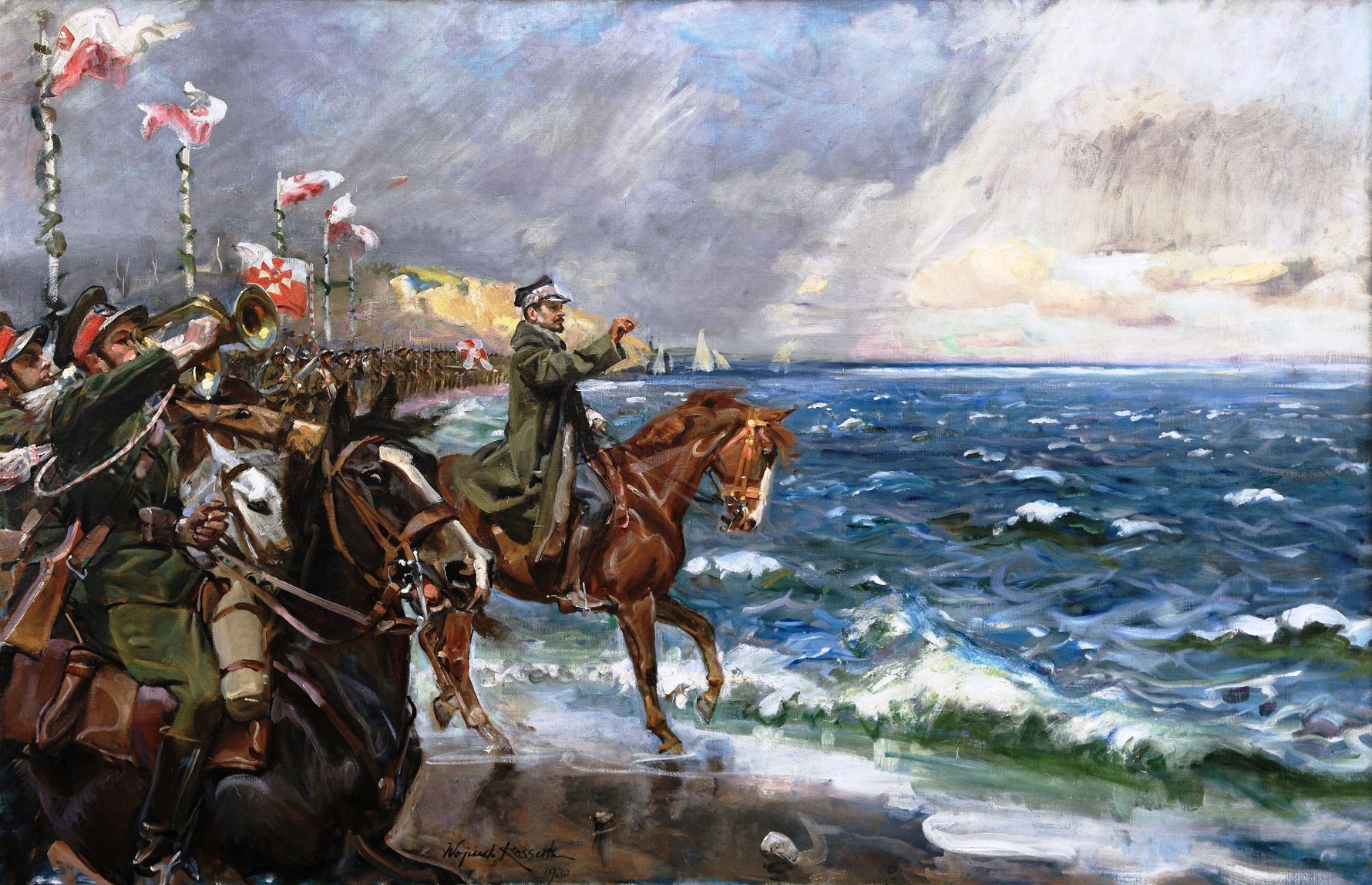
Poland's Wedding to the Sea painted by Wojciech Kossak, 1931.
This ceremony on February 10, 1920, by General Józef Haller (center) at Puck, north of Gdynia, symbolized restored Polish access to the Baltic Sea that was lost in 1793 by the Partitions of Poland.
The Legacy of the Polish Corridor
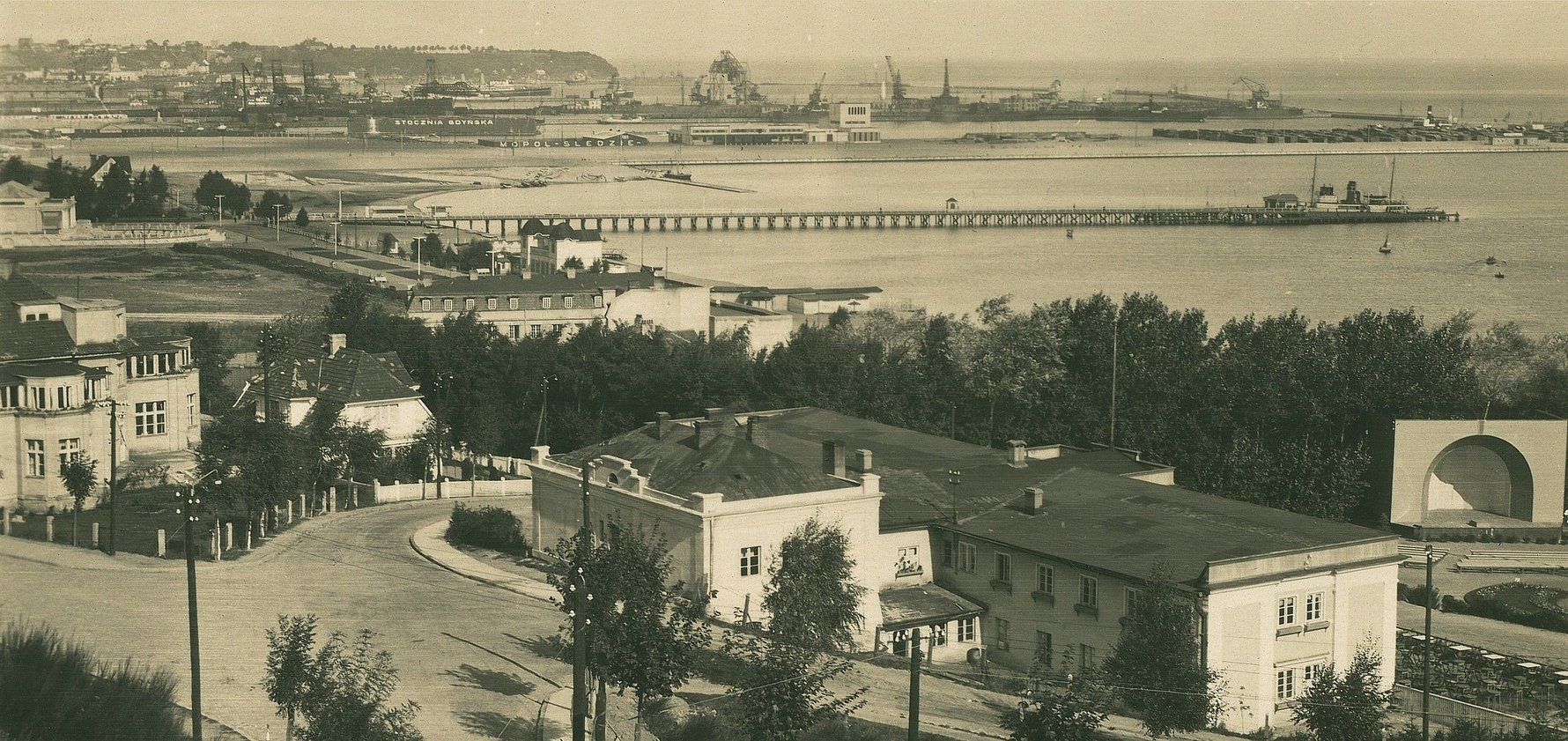
Polish access to Baltic sea and the economic rivalry with Danzig encouraged Poland to develop their own trade routes from the Baltic. Thus, the tiny fishing village of Gdynia was selected as the site to be developed into the Republic's main port. It was granted City Rights in 1923 and 'Poland's Gateway to the World' had been opened. Read more about Gdynia's interwar development.
The Polish Corridor spurred on the development of Gdynia, which grew rapidly from 1926 onwards. Photo Credit: Fotopolska.pl
The most controversial legacy of the Polish Corridor was the significant decrease of ethnic Germans from the area. Historians argue on a number of points, especially whether these individuals were forced out or simply left on their own terms. Following centuries of Germanisation and especially during Frederick the Great's reign in Prussia (1740-1786), there is no doubt that post-war anti-German sentiment existed in Poland. American-German historian Richard Blanke cites a number of reasons for the mass 'exodus' in his book Orphans of Versailles, including the avoidance of conscription during the Polish-Bolshevik War (1919-1921), a refusal to live in a Polish state with Polish as the only official language, Poland's lower standard of living compared to Germany and a general fear of Polish reprisal, harrassment and discrimination.
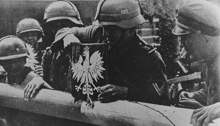
German soldiers removing the Polish coat-of-arms from the border post of Danzig and the Polish Corridor during Hitler's invasion of Poland, September 1939.
The humiliation of the loss of German territory, which included the independence of Danzig and the Polish territory separating East Prussia from the main sovereign body, was one of several reasons that lead the imbittered and economically-devastated Germany towards extreme nationalism. Hitler and the Nazi Party came to power in Germany and his eyes were long set on reclaiming Polish lands that he saw as historically-German. Such a point of contention was the Baltic coast that the opening shots of World War Two were fired upon the Polish-controlled arms depot of Westerplatte in Danzig. The occupation of Danzig and Poland was lifted by the Russian 'liberation' of the region in 1945.
Ironically, following the end of WWII, Poland would gain more territory on the Baltic, making the previous 'corridor' looking like a mere wedge. These borders would remain, long after Russian communist influence had been ousted in 1989.


Comments